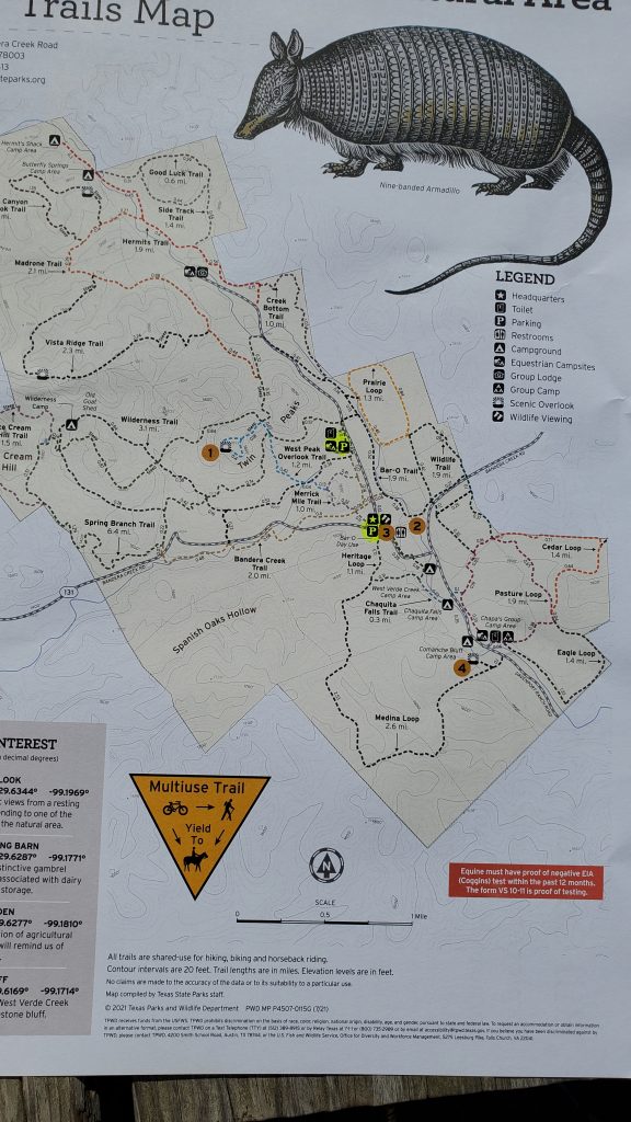
Just past the town of Bandera, the “Cowboy Capital of the World”, lies the Hill Country State Natural Area. The 5000 acre+ park hosts over 40 miles of off-road running and multi-use trails. The map you get at the visitor’s center (after paying the $6 admission fee) shows that you have a lot of options here. You definitely want to take the map and be sure where you are going: a wrong turn will leave you in a remote area of the park, on technical terrain, with very low traffic and no cell signal. But – this park is worth your time!
The park is about an hour’s scenic drive from North West San Antonio.
Hill Country SNA
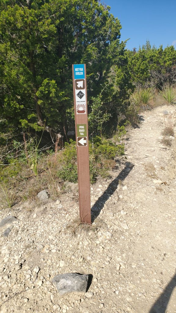
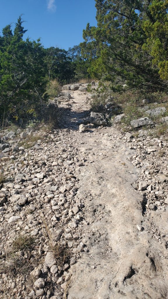
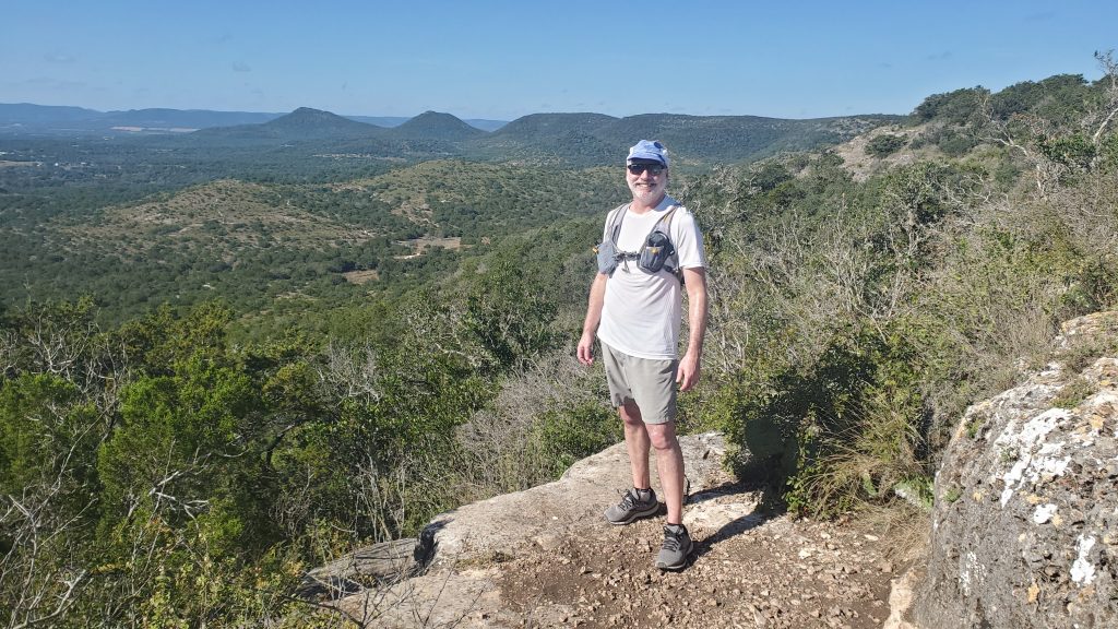
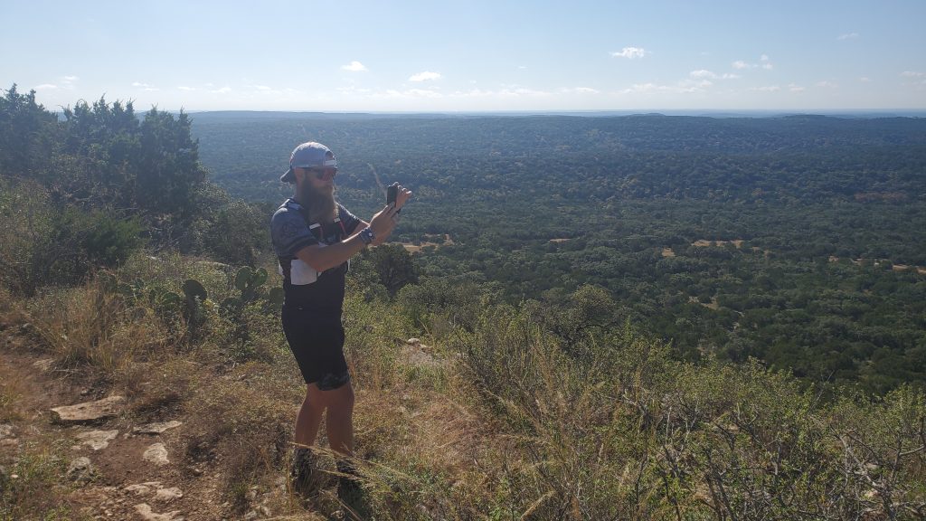
On my visit with Fairweather Steve https://www.facebook.com/FWS.motivation, we chose to do the ascent to Scenic Overlook on the western peak of the Twin Peaks. This is labelled on the map with some fine print that reads simply “steep”. It was. We went up West Peak Overlook trail with a nice rocky uphill. This is a technical trail, so if you are out for an easy walk, this is not for you. The trail was decently maintained and marked, so it made for a fun run.
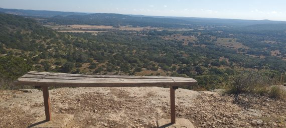
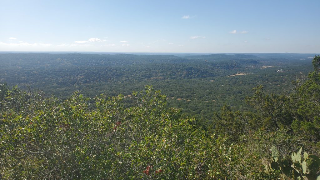
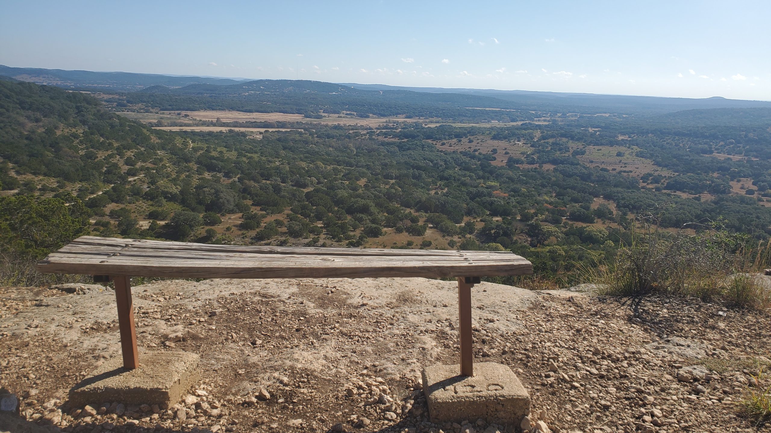
At the top of the overlook are a few benches to soak in the view. We were there on a beautiful day in the 70s, and the pictures don’t do justice to the feeling of being there: seeing the view itself, and only noises of the wilderness.
The trail circles the top of the peak, and we managed to flush out about 20 birds from the underbrush on the way down. The descent is runnable, with a few big steps and watch your steps sections.
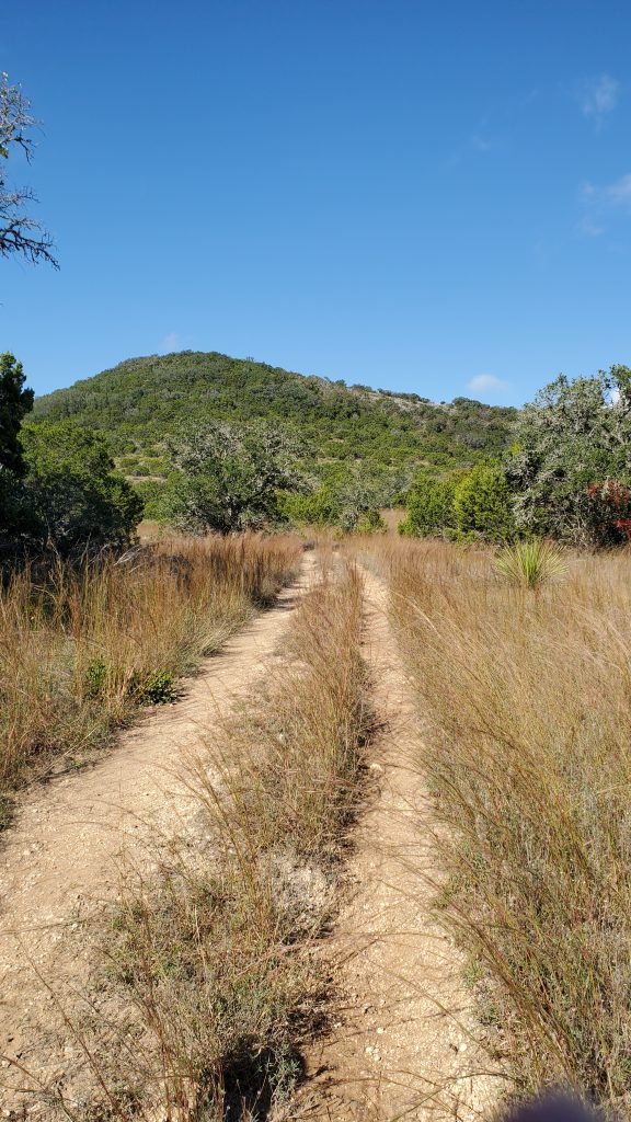
At the bottom of the descent we turned left to join Heritage Loop. This was a nice descent over decent trail with some scree and small drop offs to pay attention to.
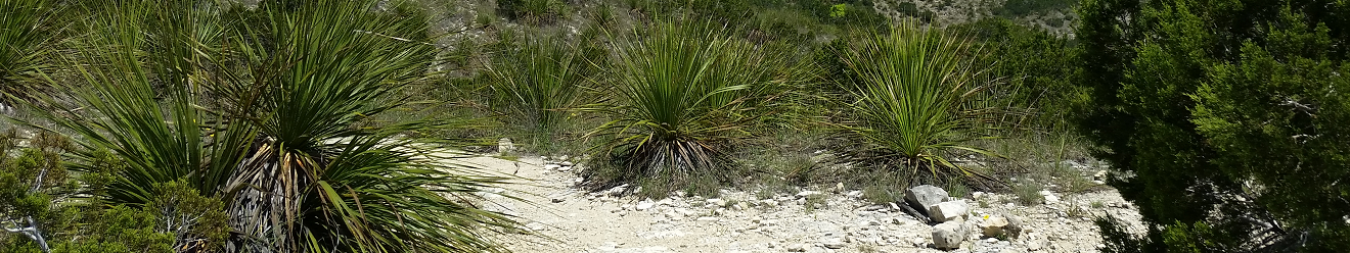
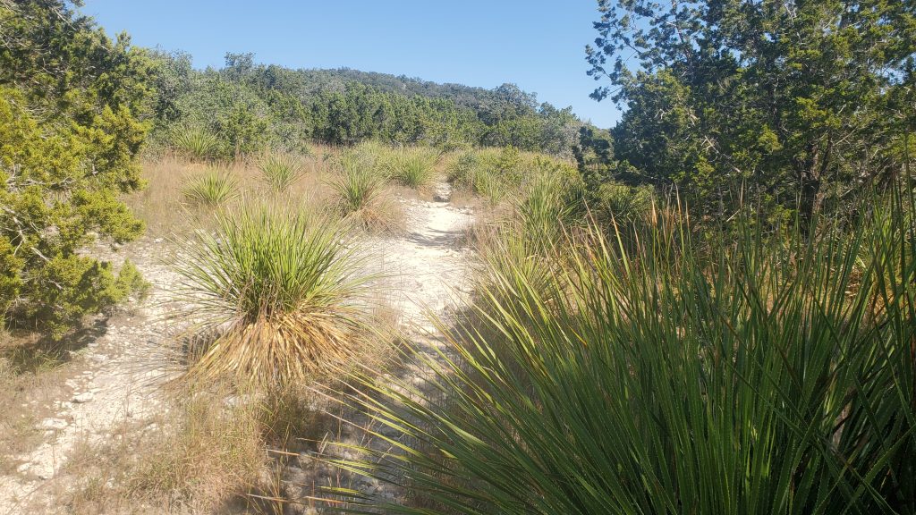
After consulting our map just to be sure, we hooked a few lefts to stay on Heritage Loop so that we could circle the Twin Peaks and head back to the road. The path stayed pretty level on the shoulder of the peaks, and we ran through Yucca encroached trails. There is something special about showing off the Yucca cuts on your shins to your wife and watching her grimace!
The final descent to the road was a wide path that meandered around a bit:
Descent to the Road on the North branch of Heritage Loop
At the road, we ran on a nice shaded single track that felt a bit too easy after the climbs we had done. We only saw four hikers in the hour and a half we were there, but also four people on horse back.
Pro Tips:
- Great Park with lots of options, but take the map from the visitors center with you.
- Plan your route. If you make a wrong turn you can easily get in too deep to fast here.
- Cell service is spotty, at best, in the park.
- Take plenty of water and some nutrition, just in cases.
- This is technical. Expect climbs, descents, big steps, rocks, and being attacked by Yucca.
- You’ll be sharing the trail with Horses and Bikes, be courteous.
- Forest service – style restrooms are at most of the parking areas.
- Make reservations online in advance. There are Park Closures sometimes, and you don’t want to drive all the way out to a closed park. https://tpwd.texas.gov/state-parks/park-reservation-information/reservations
Awesome read. Pictures never do it justice. The sunrise from the equestrian parking area is the best if you get there in time. Keep exploring!
Love the blog! Very interesting read.
Two questions.
Who placed the camera that you ran by?
Who did you run with?
Camera work is self-done. Setup the camera, then run back up and then back down the hill, then back up to the camera to pick it up. 3X the work for 10 seconds of footage 🙂
Steve is an absolutely inspiring athlete & storyteller.
Thank you Shad. One day we will have to bring you out with us to make a guest appearance.